 |
|
Last update
2005-01-24
|
GPS Survey
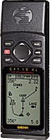 Handheld GPS receivers have been used to trace the loci of roads and pipelines as well as to record the positions of landmarks.
Specifications
Technical Description
References
- Sakamoto, S. 2001, "Coordinates of roads, pipelines, and landmarks near the ALMA site," ALMA Memo 375